|
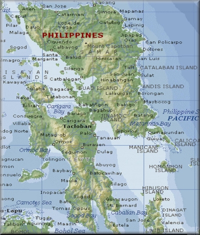
At present, the AOR of the 8th Infantry (STORM TROOPERS)
Division, Philippine Army covers the whole of Eastern
Visayas (Islands of Samar, Leyte and Biliran). It comprises
of six (6) provinces, four (4) cities, one hundred thirty
nine (139) municipalities and four thousand four hundred
twenty one (4,421) barangays or 10% of the total barangays
nation wide. It has a total registered population of
3.9 million as of 2000 census and a land area of 21,431.7
square kilometers which represents 7.2% of the country's
total land area. The Regional Center is the City of
Tacloban, around 107 kms south from this headquarters.
 |
|
About Samar
What is now Eastern Samar was the
first area of the Philippines sighted by Magellan
on March 16, 1521. Magellan´s crew called the
island´s lofty mountains Zamal. The Spaniards,
however, anchored at the tiny island of Homonhon
on the southern part of the province. During the
early days of the Spanish rule, the province of
Samar was called "Ibabao". The towns of Borongan,
Sulat and Balangiga became religous centers. Borongan
was also a center of trade and a military outpost
of Spain in the Pacific Ocean. The province of
Eastern Samar was created june 19, 1965, which
divided Samar Island into tree provinces.
|
|